 The final walk of the season took us to the opposite side of the valley from our first; our three summer walks comprise a trio of locations that demonstrate the importance of rivers and streams in the history of Mill Brow, New Mills and our final destination, Mellor Hilltop.
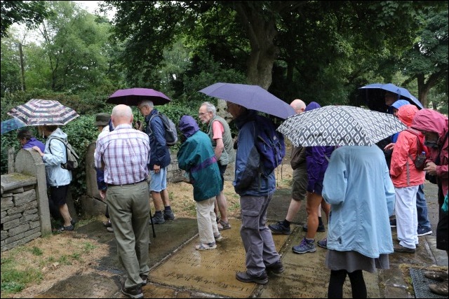
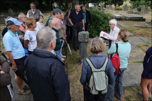
On what was for the remarkable summer of ’18, a grey evening, we gathered by dribs and drabs, around Ann resting on the wall of the Vicarage. The party of 32 was brought to order, shortly after seven o’clock, the 18,664th episode of the Archers would just have to be missed!
Ann indicated that the stroll this evening would consider three aspects of Hilltop history: the Church and Graveyard, the Old Vicarage and the Iron Age Fort. The latter, as Ann explained, was a development that owed much to a mantra still in vogue 10,000 years later, location, location, location.
The graveyard, wherein lie the remains of a medieval cross and a pair of stone shafts of stocks in all probability dating from 17th century. Also within the churchyard a headstone with Masonic symbols, for Thomas Brierley. The footprint of Mellor School allowed Ann to give us a résumé of its history.
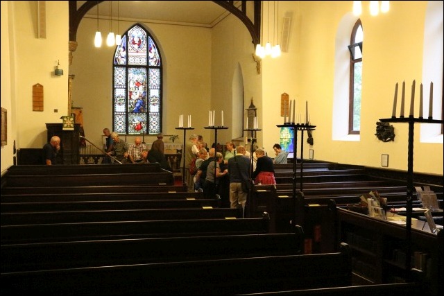
With LouiseThistleton sweeping up stragglers, we entered the sanctuary of the church. Dutifully sitting in the pews, Ann begins to enlighten us on history of the building. This dates from the early 14th Century, just before the ‘Black Death’. In 1783 the walls were partly rebuilt, and galleries on the south, east and west walls were constructed to accommodate the new organ and choir. The Church at this time could seat seven hundred people compared to the present capacity of barely two hundred!
Two important items of furniture lie within the church, the 14th century pulpit and a late Anglo Saxon Font. Whilst inspecting the pulpit, the comment was passed that they must have been thin clergy then.
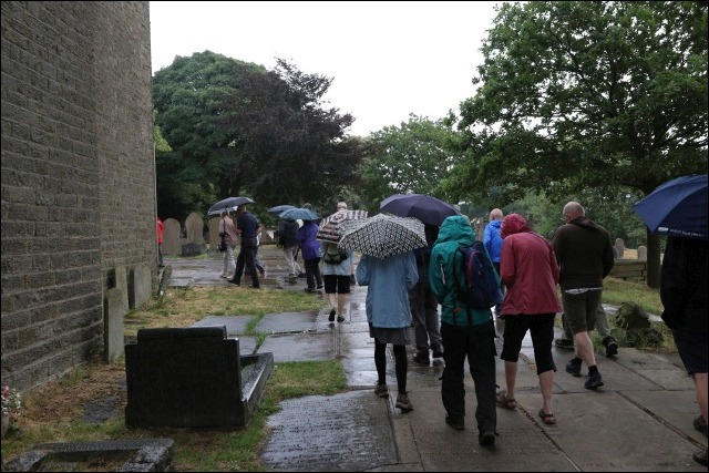
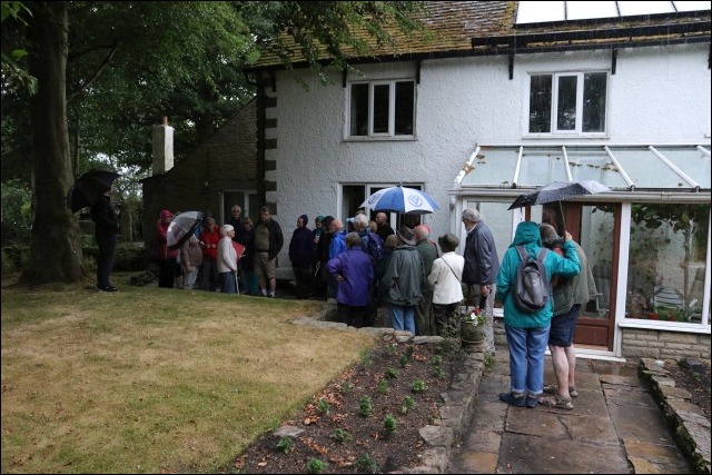
The history of the church is entwined with the history of the Old Vicarage, our next stop. Emerging, from the church, we met the strange phenomenon of rain! Umbrellas were unfurled, waterproofs donned.
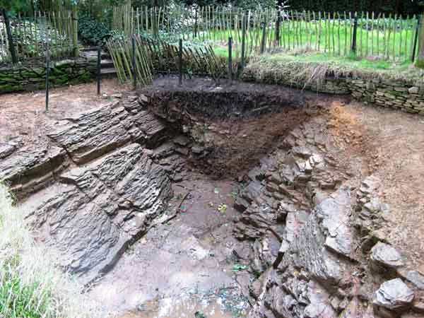 The ditch at Mellor Hilltop Fort. There is permanent access to view this section of the ditch from a path leading off the church car park.In the midst of massed umbrellas Ann tells us that the first reference to the house that has been found relates it being an Alehouse in 1571. Beams inside have been dated as 1512, but they may have been second-hand. Two pigs and five barrels of beer were amongst an inventory from 1680 for one Gilbert Radcliffe, owner of the house. Curates occupied the house until the turn of the 20th century. (The Old Vicarage, never a Vicarage' - Ann Hearle talk)
As the summer of 2018 continues to break record upon record, the scorched countryside is yielding clues around the country of the past (Hidden landscapes the heatwave is revealing)
Similarly, more than twenty years ago, during the hot summer of 1995, eagle-eyed Ann spotted unusual markings, both in her garden, and in the adjacent field of Knowle Farm, owned by Peter Hodgson. In the autumn of 1997 they were visited by Peter Arrowsmith, author of ‘Stockport, a History’ who examined the photographs and took a walk around the hill top. He started to think there may have been a very early occupation of the site. Peter contacted a colleague from the University of Manchester Archaeological Unit, Graham Eyre-Morgan and set in motion a train of events which would lead to the creation of the Mellor Archaeological Trust and the discovery of 10,000 years of History. (The reports on the ten digs from 1998 to 2008 are online: Digs 1998 -2008)
Our evening drew to a somewhat premature close (the rain you understand) by a section of Iron Age ditch sold for £1 by Ann & John Hearle.
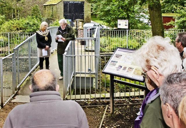
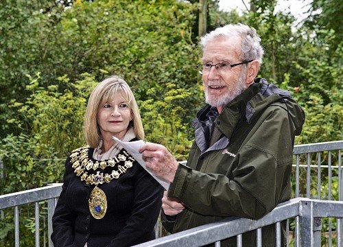
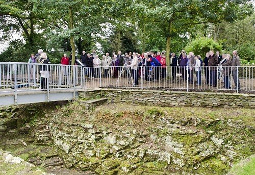 Handover Event, Sunday, 30th September 2012“A corner of Ann & John Hearle's garden has transferred ownership to the people of Stockport represented by SMBC. That part contains the exposed part of the Iron-Age ditch with the bridge over from the Roman Garden to the far side with Interpretation Boards.”
Handover Event, Sunday, 30th September 2012
This permanent show of the toil of the local workers 10,000 years ago was a fitting conclusion to the evening. The Society season of 2017/18 with its eight talks, four trips and three walks drew to a conclusion. We re-convene on Monday September 17th at 7:45pm, prompt!
To close, our thanks to Ann for her expert, blue-badged guidance around this deep pocket of local history, a splendid July evening.
Text: Martin Cruickshank
Photos: David Burridge and Arthur Procter (handover shots, 2012)