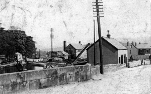
Brabyns Brow marks an obvious division in the Marple flight between the lower eight and upper eight locks. It is approximately halfway, not just in the number of locks but also in the distance covered. Another distinction is that this is the point at which the towpath crosses over the canal. The towpath is on the eastern side for the lower eight locks but crosses over to the western side for the upper eight. Hence the adjective “crossover” for bridges such as the one at Brabyns Brow. The siting of the towpath was not an incidental decision taken by the builders. The 1794 Act incorporating the canal company specified that the towpath was to be on the west bank where it passed Samuel Oldknow’s land. He might be the motive force behind the canal but he did not want any rough bargees traipsing over his land.
The whole flight of locks was ground-breaking at the time and even now is exceptional on the canal network. Benjamin Outram was working close to the known limits of lock technology. He proposed sixteen locks, each with a rise of over thirteen feet, when the norm at the time was 8 - 10 feet. It was not a straight flight but curved around a shoulder of high ground with the east side of the canal on the downhill side. This minimised the amount of excavation necessary. He designed the upper locks first on the steepest rise. They were spaced just sufficiently far apart to allow two boats to pass between locks and the necessary height for these upper locks - 13 ft 1 inch - was then applied uniformly to the whole flight.
The canal directors were concerned about the advanced design and apprehensive about possible failure. He was put under pressure to change the design and increase the number of the locks in order to reduce the depth of each one but he stuck to his guns, pointing out that extra costs would be incurred. Not only the cost of extra locks but additional earthworks to reduce the gradient near the top of the locks. On top of all that it would involve boats in taking extra time to navigate the locks. Not yet thirty, Outram convinced his clients that the design was feasible and economic.
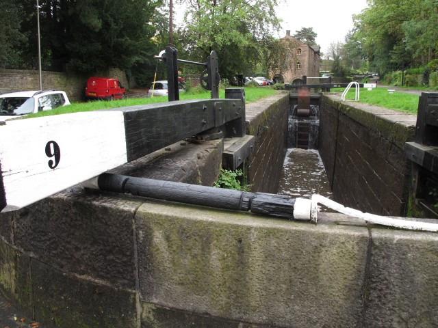
Lock 9
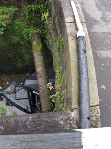
If proof is needed that Brabyns Brow is a changeover bridge there is a wooden roller mounted on the bridge wall close to Lock 9, which prevented the tow rope from abrading on the stonework as the horse crossed over. The deep grooves on the roller show that it did its job effectively. The bridge is much wider now than when it was first built. If you want to see the original bridge there is a footway with safety railing under the road, accessible from the downstream side.
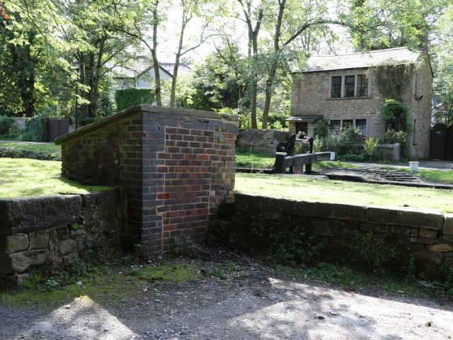
Just above Lock 9, opposite the towpath, is a small brick shed. This was the control shed for diverting water from the canal to the railway. The steam engines which passed through Marple 60 years after the canal was built needed large quantities of water to create their steam. They would fill up from the large tank at the station which, in turn, would be filled by water from the canal. The foundations of the tank can still be seen above Platform One. However, water was a precious commodity and the canal company charged the railway for this supply, even though they were both owned by the same parent company. The brick shed contained the valves and meters which controlled this supply. Until a few years ago the shed had an open door but the health and safety guardians have bricked it up completely though, to be fair, they have made a very neat job.
 The Lock Cottage on the towpath side was a later addition as the early canal only allowed locks to be used during daylight hours. When the Macclesfield Canal was opened in 1831 the night time restiction on passage through the locks was lifted. This required the appointment of more lock-tenters (keepers) together with houses for them. As well as at this lock, other cottages were built at Bottom Lock, Lock 6 and Top Lock. There was also a stable (now demolished) adjacent to this cottage for canal company horses. To the left of the cottage in the photograph.
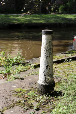
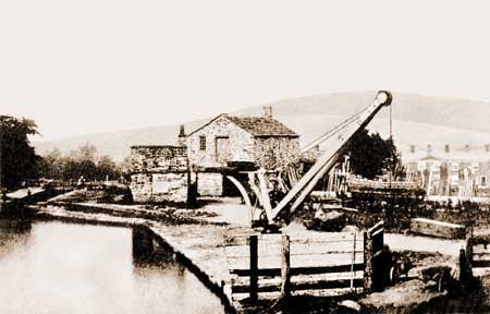
Beyond the brick shed, on the same side, is a cast iron post, about one metre high but firmly fixed into the ground with a base plate. This is the base for a crane that was sited here to load and unload the narrowboats that did not need to go into the warehouse. The warehouse nearby was built by Oldknow as the key intermodal point for transport to and from Mellor Mill. It is a substantial building which could store goods for a time when necessary, as well as transferring raw materials and finished goods between waggons and boats. Important cargoes could be handled under cover as the warehouse allowed boats to be brought inside but most transfers were made by hoist. On both sides of the warehouse there is a projecting cross-gable which supported block and tackle gear. Indeed on the landward side what is probably the supporting hook can still be seen.
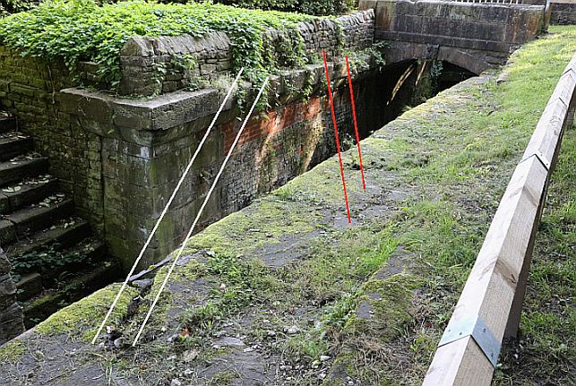
This pound above Lock 9 was a centre of activity for much of its life. Even before the locks were built, a tramway was constructed to carry limestone from the upper canal section to the lower and it crossed over the canal just above the warehouse, over the tail of the lock. The grooves of the tram rails can still be seen on both sides of the lock, crossing it at an acute angle on its way to the west side of the lower section of the canal. Although disguised by moss and other vegetation, the grooves can be seen more clearly on the towpath side of the lock, but by sighting along their line, the matching grooves on the other side can be clearly discerned.
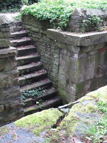 There is also a set of steps leading down to the canal at this point. They are relatively wide and straight, unlike the steps provided for the boatmen at other locks. When the canal was first built, Samuel Oldknow constructed a road from his warehouse directly to Mellor Mill. The first part of this was called Wharf Road though it is now St Martin’s Road. This was a useful passage for other people as well, so Oldknow decided to turn it into a private turnpike. Because it was on land that he owned there was no need to create a Parliamentary Turnpike Trust, he could just erect a turnpike and start charging. A gate barred Wharf Road at this point and the tollkeeper who lived in Turnpike Cottage, charged users to travel on the road. It is also thought that some fees were charged for boats using the canal which is why the steps were built. However, most fees were paid either at Top Lock or Bottom Lock - it is not known why any charge should be made at this point. Any suggestions would be welcome.
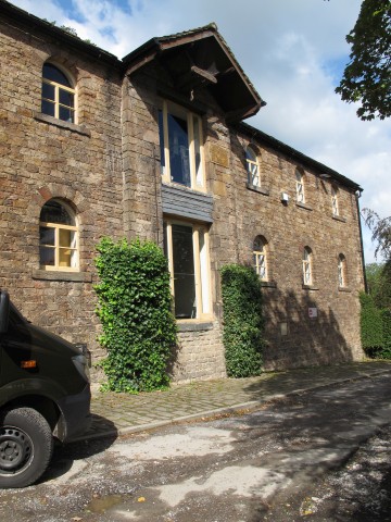
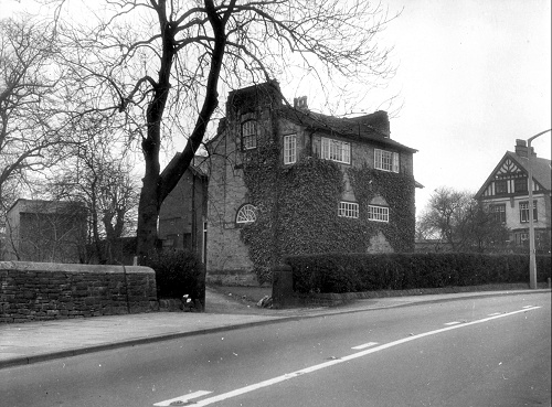
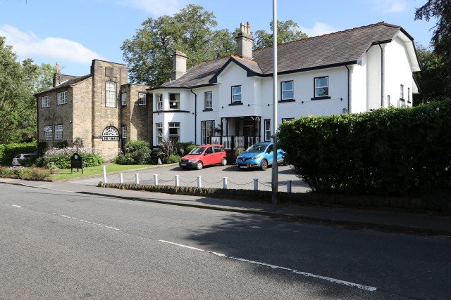
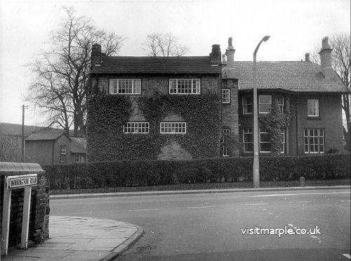
Brabyns House, (below) just uphill from Lock 9 was originally the home and office of the Principal Agent for the canal, in effect the head office for the canal company. It has been greatly extended over the years and is now a retirement home.
Lock 10
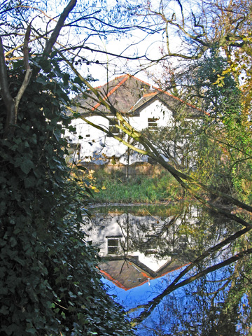
The pound for lock 10 (below), just above the warehouse, is bigger than it looks. A channel feeds into the pound from the west side as there is a side reservoir in the garden of Brabyns House. This increases the water capacity of the small pound quite considerably. The same solution is used for the three topmost locks and also Lock 6.
The eastern side of this pound was a coal wharf for much of its history although there is no sign of it now. Known as Arkwright’s Wharf, it was operated by various contractors, the Arkwright family was the landlord.
This photograph, taken in 2008, shows the pound at the back of Brabyns House.
 Lock 10 pound
 Lock 11 repairs
Lock 11
At Lock 11 the signs of the recent repairs (above) are still evident though the contractors have made an excellent remedial job. The mortar between the stones is still fresh and bright and a long length of wall between the towpath and the park has been rebuilt as it had to be demolished to allow access for large equipment. The problem arose when it was realised that the walls of the lock had begun to bulge inwards. With narrow canals all based on standard measurements for locks, channels and boats, this was obviously a problem that had to be repaired quickly and it has now been fixed, hopefully for another two hundred years. 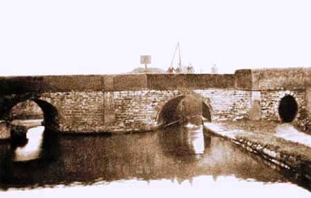
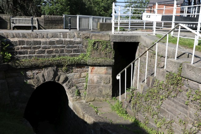
The pound for Lock 12 (above) was probably the most active area on the whole flight of locks. Located where the canal passed under the turnpike, it was also the junction with two private branches and the site of a busy wharf. Viewing the bridge (and Lock 13) from the pound of Lock 12 the central arch is the canal whilst the left hand arch, now blocked, was the entry point for a private branch from the lime kilns. On the eastern side of the basin there was a large coal yard (hence the name Black Wharf), Moult’s Timber Yard, a blacksmith’s shop and various workshops.
|
|
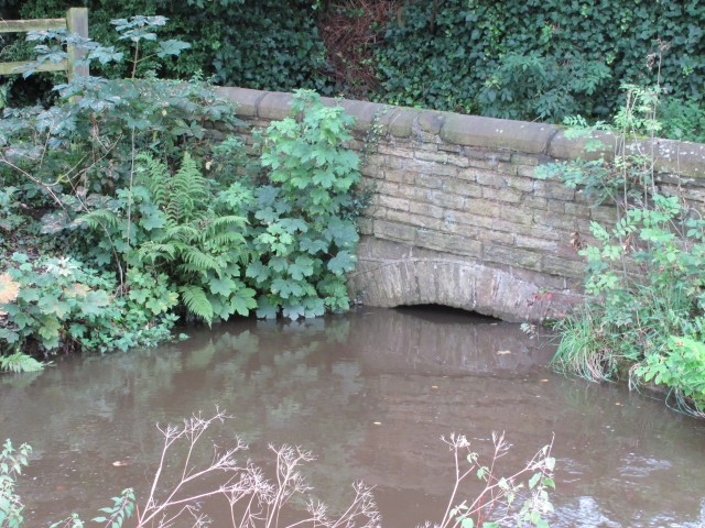
When Hollins Mill was established the owner, Charles Walmsley, dug a private branch to the mill yard from the main canal. Rather than build the bridge to take the towpath over his branch, he asked the company to do it. They charged him £111. Although this branch has been completely filled in, the arch of a buried bridge can still be seen in the corner of Memorial Park near the road but hidden by brambles and nettles. In the private land behind the cinema are what appear to be the coping stones for the private branch. Back on the towpath the red brick wall is what remains of the bridge built for the towpath to cross the mouth of this branch.
|
|
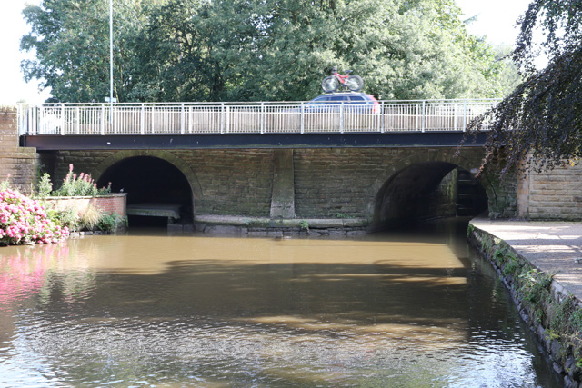
The bridge over the main canal was entrusted to Samuel Oldknow to build. As well as being a leading shareholder in the canal he had a particular concern because of the lime kiln complex he was building. He had a personal ambition that one of his boats should be first down the completed lock flight so to that end he was very involved in the construction of the bridge. To encourage the workmen he arranged for an ale posset to be given to each man for breakfast. It obviously worked as the bridge was completed on time and his boat, Perseverance, was the first. The bridge is called Posset Bridge to this day. The keystone on the bridge has the date “Erected Octr 13th 1804” but it is badly eroded and scarcely legible.
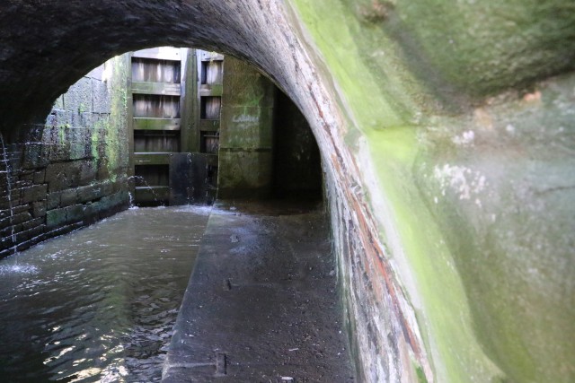
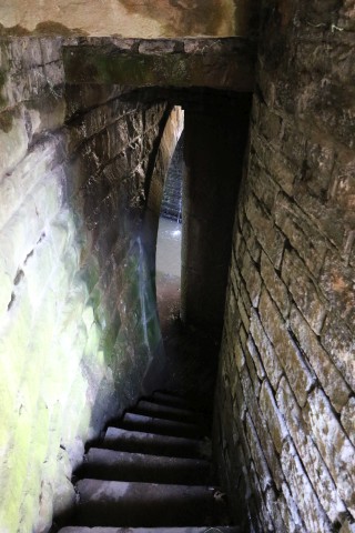
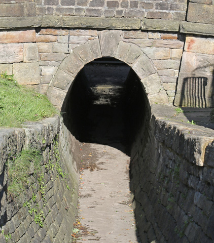 There is one further tunnel under Posset Bridge, an oval shaped tunnel for horses. This was a later addition, probably because the traffic along the road distracted the canal horses when they were freed from their harness. As Oldknow had built the original he was asked to make the extension in 1815, when he was allowed £40 for the purpose. Although the horses would use the tunnel the boatmen would continue to use the steps and pathway under the main bridge. The oval shape of the tunnel is to ensure that the swingle tree of the horse's harness could pass through without snagging.
Above Posset Bridge are the last four locks in the flight. This top section of Locks - 13 to 16 - has a gradient of 1 in 16 and is the steepest flight in the country apart from staircase locks. The pounds for these three locks are very short indeed so their water capacity was increased substantially by building small side reservoirs.
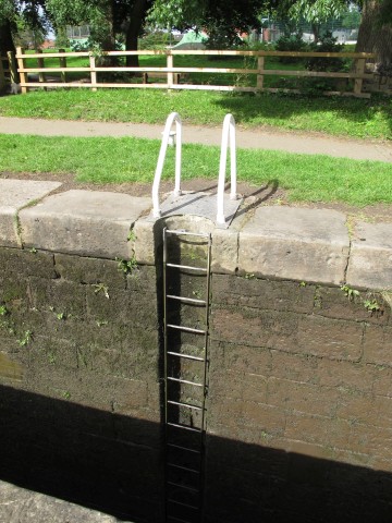
In each of these locks, indeed like all the other locks in the flight, there is a semi-circular channel cut into the side of the lock and a ladder fixed to it, extending to the bottom of the lock. This is a safety feature so that if someone falls into the lock when the water is low, they can get themselves back to safety. Surprisingly it is only in the last twenty years that these have been installed, telling us a lot about the culture of safety for most of the lifetime of the canal. When the canal was working as an active commercial artery, reports of deaths by drowning were relatively common for both boatmen and canal employees, particularly lock keepers.
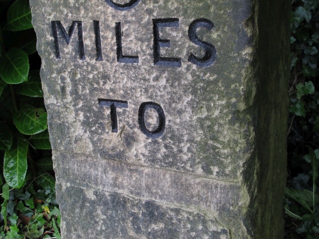
 At Lock 15 the eight mile stone is embedded on the far side of the lock. All the milestones of the Peak Forest Canal have this distinctive shape and those marking an even number of miles are larger and thicker than those marking half miles. This one is similar to the seven mile marker at Bottom Lock but bigger than the 7.5 mile marker between locks 7 and 8. The distinctive feature on this one is that the destination has been carefully chiselled out. This is not random vandalism but probably the work of a careful Home Guard member who did not want to give the invading German army a clue as to how to get to Ashton.
And so we come to the end of our long climb. But is it the end? There is much of historical interest above Lock 16 and the whole area is colloquially known as “Top Lock”, not just the actual lock. However, that will have to wait for another day - perhaps next time.
(To see the chiselled out section in more detail, click on the photo)
Further reading:
Neil Mullineux- text
David Burridge - contemporary photos