Marple - A nineteenth century failure?
An examination of the growth of the cotton industry in Marple and the reasons why it did not succeed.
Author: Ann Hearle & Fred North.
Published: Marple Local History Society, 1996.
A5 booklet, 20 pages, 6 illustrations.
Price: OUT OF STOCK
ISBN: 0 95422716 5 6
Contents:
- Introduction
- Census returns
- Mobility
- Economic growth
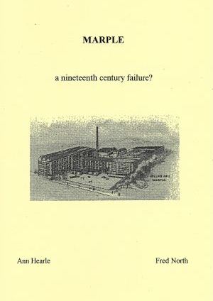
- The mills
Introduction
Marple today is a small town within the south-east boundary of the conurbation of Greater Manchester and is now a dormitory suburb. It has a population of just over twenty four thousand, living in several centres and some scattered hamlets.
In the early years of the nineteenth century there was a range of industrial activity, dominated by the textile industry powered by the River Goyt and its tributaries. With the opening of the Peak Forest Canal in 1804 and the Macclesfield Canal in 1831, Maple became an important communications centre. The canals themselves affected the industrial location as mills were built along their banks. The arrival of the railway in the 1860's marked the start of the slow transformation of the area into a residential one for people working in Stockport, Manchester and other nearby towns.
The area now known as Marple and District (M&D) has been well documented, including ''Mellor Heritage'' 1985, ''Historic Industries of Marple and Mellor'' 1989 and the ''History of Marple and District'' 1993. However this study was made to see if the census returns could add anything to the existing accounts. The period was from 1841 to l 891 and the area included Marple Mellor, Ludworth and Compstall, around 8,600 people in 7500 acres, partly in Cheshire and with Ludworth and Mellor in Derbyshire.
